Posts

EFFECT OF "NATION-WIDE LOCKDOWN" ON INDIAN WEATHER PATTERNS
Image
****** Abstract: Nation-wide lockdown has lead to reduced emissions and has definitely improved the air quality. However, there is no consensus on how the local temperature and cloud patterns are affected. Using some basic open source data and weather dynamics concept, I am going to show that the lockdown will have inverse effect on temperature, wherein we could expect warmer temperatures and increasing heat-wave like situations in April and May 2020.  Moreover, due to increased heating, it is possible that thunderstorm activity will increase and some intense thunderstorms could be in the offing in May 2020. ****** E ver since the national lockdown, the quality of air that we breathe has improved substantially. There is absolutely no opposition to the fact that the AQI index has drastically come down in all the Indian cities.  So much so that people have been enjoying the beautiful view of snow clad Himalayan mountain ranges from miles way. On the coastal side, ther...
MONSOON 2020: CAN IT WASH OUT THE NEGATIVE IMPACTS OF COVID19?

Image
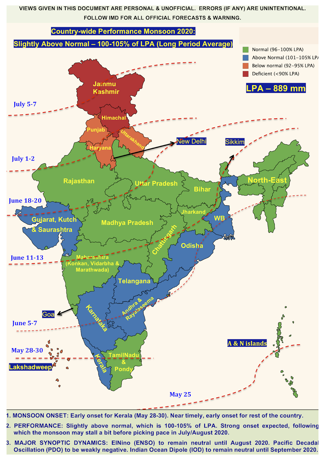
A s I write this blog, India is battling a deadly outbreak, COVID-19, that has caused a lot of distress to many echelons of our society. As we approach closer to the end of the "National Lockdown", one could only hope and pray that we have caught the beginning of a plateauing curve for this life-threatening virus.  For an agrarian country like India, usually at this time of the year the performance of the " Indian summer monsoon " attracts all the curiosity, owing to its notorious nature. But this year, we already have started with so much negative impact that the pressure on "Monsoon 2020 performance" is more than ever. Among all this, we could only hope that a good monsoon washes down all the negativity and brings our economy on track. With this preface, let us move on the ( unofficial ) Monsoon 2020 forecast. Monsoon 2020 has a lot of hope riding on it. It is following a bumper bumper (yes I am indeed it twice) Monsoon 2019, which was 110% o...

Why monsoon is a hard nut to crack?

Image
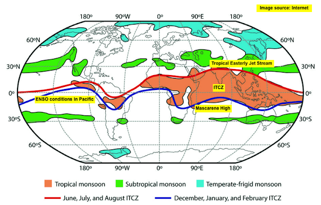
The infamous Indian monsoon is a bitter-sweet intra-seasonal system known to bring its share of joy and sorrow. Probably one of the very few weather systems world-wide that has such a characteristic. People eagerly look forward to the monsoon showers (that gives respite from the scorching heat) and at the same time dread the fury that it brings along. Monsoon, in short, is an atmosphere-ocean (or air-sea) coupled system that brings widespread rains primarily to the tropical belt. From India's viewpoint, it is indispensable for agriculture and is dubbed as the real " finance minister " of the country. Well, from the basic definition of monsoon, it looks like if we capture the air-sea interactions, then one could have the monsoon dynamics fully figured out. Yes, true, but it comes with a caveat, and not just one...many! Atmosphere and ocean are dynamically controlled by various parameters namely, wind (zonal, meridional, and vertical components), air temperature, pres...

Weather world bids adieu to 2019

The year 2019 probably was one of the best, as far as weather dynamics were concerned. So many interesting and record breaking events occurred. From the Indian context, it was a roller coaster year with many unseasonal phenomenon. A few of them are listed here: 1. Cyclones during monsoon onset & monsoon withdrawal. 2. Super-duper south west monsoon for west coast and central India.  Satisfactory North east monsoon. The North east monsoon was fully driven by tropical wave activity. 3. Unseasonal rains in many places (especially Maharashtra) during November and December. 4. Super cyclone (Kyaar) in the Arabian Sea. 5. Post monsoon, Arabian Sea becomes quiet and Bay of Bengal roars.  This year it was opposite; Arabian Sea was super active until the year end. Lowest number of storms in Bay of Bengal, which generally is known for churning storms between October and December. 6. Coldest December on record for North India. Strong Western Disturba...

Is Delhi the PRIMARY source for Chennai Smog? Physics says NO

Image
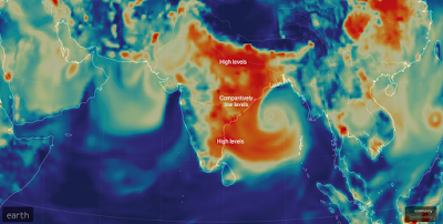
The plume picture has sparked a debate saying Delhi's bad air has traveled to Chennai resulting in Chennai smog. Well, well, well, pictures without physics based explanation are extremely dangerous and some weather bloggers are proving their point simply using the images. Here, I try to explain the physics (in my capacity from what I know about fluid dynamics and thermodynamics). Before that, let us lay downs some facts. Fact : Chennai is reeling under a smog. No doubt about it. Some people are diverting the debate to smog vs fog.  Realise that smog is nothing but smoke+fog . So, fog is indeed a part and parcel of smog. The smoke particles get attached to the misty fog. Even if the fog goes away (due to solar convection), the smoke can hang around like a haze or drop down to ground levels (resulting in irritation and pollution to your face - when you wipe down, you will see brown or black dust). But it is a cycle, where fog will again form due to dew point concept. S...

Southwest Monsoon 2019 withdrawal and North east monsoon Onset

Southwest monsoon 2019 (SWM 2019) saw an active July and still seeing an active August. Thanks to  good rains in both these (crucial) months, overall monsoon rainfall now stands at +1%. This is good news since overall SWM 2019 season seems to be tending towards NORMAL . There are drought hit districts, due to the erratic nature of monsoon, but that discussion is for some other day. SWM 2019 withdrawal to start around September 10, 2019 Normal date for monsoon withdrawal from northern most point of India is September 1st. This date holds true if there are no major western disturbances that form late August or early September.  As I write this blog, North India is expected to receive good rains for the next few days (upto Aug 19) under the influence of monsoon axis, low pressure system, and western disturbance. Looking at the forecast, it seem like weak Western Disturbance is likely to form end of August. If this happens, monsoon withdrawal would be delayed by 1 we...

Dynamics behind extreme rains in Ghat section between Aug 06-09, 2019

Image
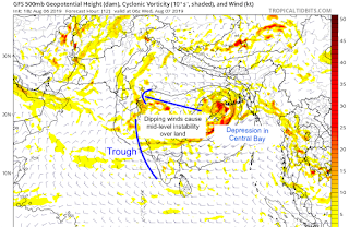
Very heavy rains are no stranger to Ghat sections of Maharastra, Karnataka, Kerala, and TamilNadu and the districts nestled within the Nilgiris and the Sahyadris. However, extremely extremely heavy rains ( > 300 mm/day) that are continuous in nature require some local dynamics that help in continuous cloud burst like situation. Here, I make an attempt to explain the dynamics behind these events. BAY OF BENGAL SYSTEMS + OFFSHORE TROUGH IN ARABIAN SEA: It all starts from the "Bay of Bengal", where a low pressure system forms. Under the influence of tropical easterlies, these systems move westward towards land, and dissipate due to frictional effects, land cooling effect, and moisture dissipation (i.e. the system runs out of moisture - the heat engine needed to run the system - and hence doesn't sustain).  If the system is strong (i.e. depression or deep depression, it will go all the way to the west coast and sustain for a longer time - e.g. the sys...