Tropical cyclones and their dynamics
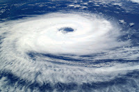
 Cyclones are massive vortical (i.e. spinning) systems with immense kinetic and thermal energies, which form in the tropical oceans and move inland. They generally have a low pressure central core surrounded by a high pressure anticyclone that helps in its intensification. Based on the core pressure & sustained peripheral winds, cyclones are categorised on a scale of 1-5.
(see: https://en.wikipedia.org/wiki/Tropical_cyclone_scales)
For any tropical cyclone, six key fluid dynamical parameters govern their genesis & track.
(a) Sea surface temperature (>27 deg C for assisting cyclone genesis)
(b) Effect of Coriolis force (f - parameter)
(c) Low pressure centre (typically < 990 millibars)
(d) Wind shear (<10 s-1)
(e) Presence of adjacent high pressure envelopes (which hinders with its movement) or any other phenomenon like a Western Disturbance and ITCZ movement.
(f) Upper level steering winds.
(f) Upper level steering winds.
CYCLOGENESIS/INTENSIFICATION:
For cyclogenesis (a), (c), & (d) play an important role. Tropics have the highest SST due to solar insolation with a typical ocean sea surface temperature (SST) ranging between 260C to 310C during any cyclone season. Under conducive SST, a weak low pressure system may start genesis and go on to become a cyclonic storm, owing to a lot of moist deep convection (something that a cyclone likes).
If the wind shear is very low (typically <10 s-1), then there is absolutely no hindrance to its development. It will organise into a nice vortical structure, and at the same time increasing its kinetic energy (i.e. wind speeds). The low pressure centre would keep reducing as the wind speeds increase (thanks to Bernoulli's principle), thereby resulting in its intensification.
Therefore, the SST, core pressure, & wind shear most likely are the factors resulting in the intensification or impedance of a cyclone.
---------------------------------------------------------
Question: The conditions mentioned above do exists most of the time in the tropical ocean, so why is it that we don’t encounter cyclones very frequently?
Answer: Although conducive temperature, pressure, and wind shear patterns exists, a low pressure system takes time to organize into a nice vortical systems, called cyclone. Therefore, these conditions should sustain for a longer time for a cyclone to form. More often that not, what happens is, there is a sudden change in the ocean/atmospheric properties, which cause disbanding of the system and renders it as a low pressure system without possibility of development into a cyclonic storm.
---------------------------------------------------------
CYCLONE TRACK:
This is the most difficult task and hence the forecasters give a cone angle for cyclone tracks. Generally couple of days prior to landfall, some clarity in the track is achieved. The track of a cyclone mostly depends on two things (from a layman's viewpoint) - (a) the amount of Coriolis force acting on it, and (b) presence of high pressure envelops, which doesn't allow the cyclone to move higher up.
Following the effect of Coriolis, another factor that may effect the track is an adjacent high pressure envelope north of the cyclone. Such an envelope won't allow the cyclone to penetrate further north, thereby maintaining a pretty much easterly track. There could be other factors like Western disturbance that could affect the track.
 Finally, the upper level geostrophic steering winds also play a role in the track of a cyclone. Since, cyclone systems have a large vertical expanse (upto 500 mb height), the upper level steering winds become important (see figure). Between ~ 00N-200N, the steering winds are easterly, and between ~ 200N-550N the steering winds are westerly (blowing west to east). Therefore, a cyclone that has breached this limit (20 N) will be curved east by the steering winds. That said, the effect of steering winds could change based on the ITCZ movement. Sometimes, there is a chance that westerly upper level steering winds would start impacting from 150N.
Both Arabian Sea and Bay of Bengal being short basins and close to the equator, the Coriolis beta-effect is not very strong, unless the cyclonic system is a severe CS (Category 3 or above) or it forms above say 100N, which allows the beta-plane effect to steer it right.
Moreover, once a system forms above 100N, then as it slowly veers right, the upper level westerly steering winds could also play an important role. Let me elaborate –
Take for e.g. a cyclonic system, which is a severe CS (category 4, packing wind speeds of 200 km/hr) and has formed at 110N & 650E (i.e in the central Arabian Sea). The nearest coastal region from where the cyclone has formed is ~1300 km on either side (i.e. Indian coast or Yemen coast).
The value of d, the deflection, for this system is d=335 km =3.350.
This means as the cyclone moves west, towards Yemen Coast (due to easterly steering wind at 110N) it is also deflected north (i.e right) by 3.350so it moves to ~15 0N. Now, the effect of westerly steering winds may slowly start affect this cyclone and turn its direction to west, thereby the cyclone could reach the Indian coast.
However, it is important to note here that if a high pressure envelop is present, then the right (i.e. north) veering due to Coriolis will be less (since a resistance is being offered - imagine you are trying to swin against a current vs swimming with the current), so it may end up moving to 130N, where the effect of westerly steer is not felt, and hence it ends up at Yemen coast.
Different weather models apply the dynamics a little differently and end up with different results for the cyclone track. If a model, say X, predicts that the CS will curve upto 15N, then westerly steering winds would automatically kick in and move it to east. On another hand, a different model, say XX, predicts its northward movement only upto 13N, then it will allow it to continue to move west to a different coast.
But fortunately, all models converge 2-3 days prior to landfall, since the cyclone would have organised well by then and a good handle of the core pressure, wind speed, its location, and development of adjacent high/low pressure zones and potential western disturbances and ITCZ movement are obtained.
Apply this concept to different cyclones that have formed in Arabian Sea and Bay of Bengal and it would make sense why they followed that particular track.
Example: Let us take Cyclone Mekunu, a very severe CS that formed in May 2018.
Location: 10.5 N and 56 E, Wind speed: 190 kmph, Distance to coast ~ 600 km.
 Applying the Coriolis effect, the deflection d~0.640. This means a mere deflection to north by 0.640 would put the cyclone at ~11.20N. However, within few hours the storm, MEKUNU, became a Very Severe CS with velocity ~ 270 kmph so the deflection would be more say around 11.60N.
THE KEY POINT IS HERE: This cyclone formed just before the onset of the Indian summer monsoon, and thus coinciding with the westerly wind shift. Further aided by the ITCZ movement up north (to set up the SWM2018 season), the cyclone was able to keep its northward motion aided by ITCZ and the upper westerly steering winds. The final track was as shown in the figure, where it ended up at 17N & 54 E (Oman coast).
You can follow my twitter handle @SriGMFL
Disclaimer: The content given here are all personal views and the author will not be held responsible or held liable for any oversight or misinterpretation.


Comments
Post a Comment