Indian Summer Monsoon 2018
A few days back, both Skymet weather
services (a private weather forecasting firm) and the Indian Meteorological
Department (IMD, a government organization) gave their predictions for the Indian
summer monsoon 2018. Overall, they painted a positive picture, where both
confirmed that monsoon 2018 is
likely to remain normal at 100% (with error margin of +/-5%) of the long period
average (LPA), where the nationwide LPA stands at 887 mm for the four-month
period from June to September (for more details on this prediction see https://www.skymetweather.com/content/tag/monsoon-2018/). To elaborate, >105% of LPA indicates
excess rainfall, <95% of LPA indicates below normal rainfall, and <90% of
LPA indicates drought. Their prediction is based on the nationwide average and
hence does not account for the state- and region-wise variabilities. Hence,
although the prediction for 2018 is ‘normal rainfall’, this does not exclude
the possibility of excessive rainfall in some regions and deficit rainfall in
other regions. This is why IMD ventured into a state-wise monsoon forecast starting 2017 (press release: https://www.livemint.com/Politics/xUCzF905YWmJZm6MuXktNL/IMD-to-start-making-statewise-monsoon-forecast-from-next-ye.html), which is going to
continue for 2018 (see the two week state-wise forecast on http://www.imd.gov.in/pages/press_release.php).
So how do these weather service
providers come up with the predictions for monsoon a few months ahead of its
arrival? The two most important phenomena that have been been linked to the
tropical monsoon season are ElNino Southern Oscillations (ENSO) and
Madden-Julian Oscillation (MJO). ENSO is specific to the equatorial Pacific
zone, associated with change in the sea surface temperature (SST) patterns
between the equatorial eastern and western Pacific. Normally, the equatorial
eastern Pacific is cooler than the
central and the western Pacific. The reversal of these temperatures
(warmer eastern Pacific and cooler western Pacific) leads to ENSO. The reversal
and and hence the onset of ENSO starts in May of a given year (say for e.g. May
2017) and reaches a mature phase during February/March of the following year
(say for e.g. Feb 2018). Hence, the weather services wait until Febraury or
March to declare their monsoon forecast, since by then the state of ENSO would
be known (i.e. whether ENSO is weak, neutral, or strong). In general, weak ENSO
means good rains for India, neutral means normal rainfall, and strong ENSO
means drought.

 The SST charts are available on National Oceanic and Atmospheric
Administration
(NOAA)
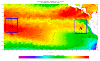
website . A sample plot for April 2018 is shown in Figure 1, which shows that
the eastern Pacific is cooler than the western Pacific. The difference is not
much, and hence it suggests neutral ENSO conditions. Imagine that weak ENSO
would have blue color (cold waters) in region
A and bright red in region B (hot
waters). Some weather service agencies also look for the SST anomaly, defined
as departure from a reference value or long-term average. A positive anomaly
indicates that the observed temperature was warmer than the
reference value, while a negative anomaly indicates that the
observed temperature was cooler than the reference value. The
anomaly plot for Pacific ocean is shown in Figure 2, where we see cooler water
in east and warm water in the west. Again the magnitude of anomaly helps in
figuring out the weak, neutral, and strong ENSO. In Figure 2, the negative
anomaly is in the eastern Pacific and positive in the western Pacific, which is
representative of neutral ENSO situation.
The other phenomenon
that affects the monsoon, and is of interest to weather service providers, is
Madden Julian Oscillation (MJO). This, unlike ENSO, is not a localized
phenomenon but propagates eastwards in various phases (phase 1 to phase 8). Of
these 8 phases, phases 3 & 4 and a little of phases 2 & 5 are
associated with rainfall activity over India. The transition from Phase 3 to 4
is generally seen as start of monsoon over India. The Phase 2 is when an array
of clouds are hanging near the equatorial region (as shown in Figure 3), and
slowly will move north-east to transition to Phase 3. During this transition,
pre-monsoon showers occur over some parts of India. Each phase lasts anywhere
between 60-90 days. Hence, phases 3 & 4 are associated with southwest
monsoon, and phases 4 & 5 are associated with the north-east monsoon.
These two phenomena
help the meteorologists give a nationwise prediction about the overall tendency
(i.e. normal, excess, drought) of the Indian monsoon. It precludes one from giving
an exact region-wise rainfall prediction. This is because the winds, moisture
(water) content, and the cloud patterns depend strongly on the orography,
vegetation, and local urban canopy.
To sum up, the positive monsoon outlook
for 2018, i.e. normal rainfall for India, given by Skymet and IMD may be good
enough, but this does not rule out any short-term extreme events that may be local
to a state or region. It should be emphasized that the normal rainfall
prediction is for entire India, which means some state may get excess and some
may be deficit (as has been happening for the past few years).
Some of my personal opinions (based on the analysis
of various diagnostics listed on numerical weather prediction - IMD) for monsoon 2018:
(a) Based on the good pre-monsoon showers in
the south (thanks to a rather active MJO phase 2 and its transition to phase 3),
it seems like Kerala, North Karnataka, and coastal regions may have above
normal rainfall .
(b) North east region may also end with up
above normal rainfall.
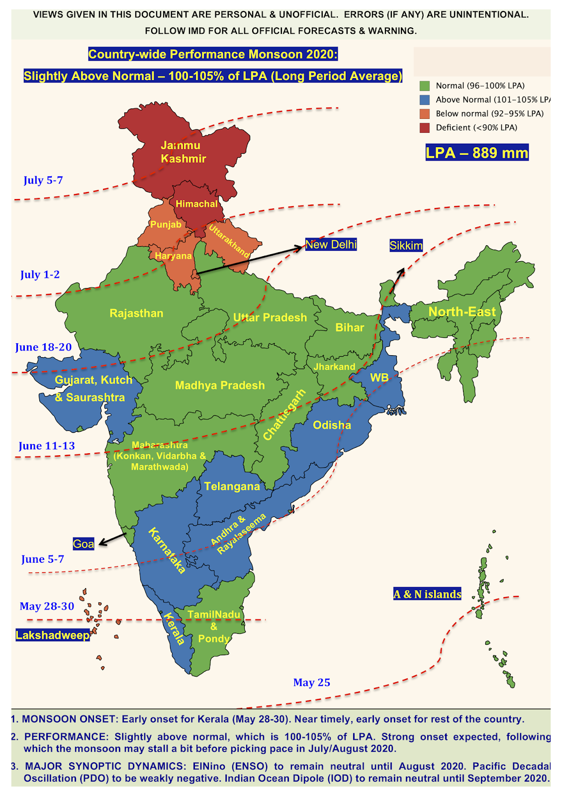
(c) Western/central parts of India (Maharastra, Madhya Pradesh, Goa
etc.) will have normal rainfall.
(d) The north Indian states (Delhi, UP, Harayana, etc.) and indo-gangetic
plains may experience below normal rainfall and hence may end with some deficit.
(e) As of now a clear picture of the north east monsoon (which brings rainfall to Tamil Nadu, coastal Andhra Pradesh, and some parts of Karnataka and Kerala) cannot be given. But due to neutral ENSO conditions, overall it is expected that north east monsoon will also be normal. A state-wise prediction (excess and deficit) can be given as and when the southwest monsoon starts its withdrawal (i.e. around September 2018).
(e) As of now a clear picture of the north east monsoon (which brings rainfall to Tamil Nadu, coastal Andhra Pradesh, and some parts of Karnataka and Kerala) cannot be given. But due to neutral ENSO conditions, overall it is expected that north east monsoon will also be normal. A state-wise prediction (excess and deficit) can be given as and when the southwest monsoon starts its withdrawal (i.e. around September 2018).
Disclaimer: The content given here are all personal views and the author
will not be held responsible or held liable for any oversight or
misinterpretation.


Well structured explanatory post. Nice reading.
ReplyDelete
DeleteThanks!