Posts

A tale of storms - thunder & dust

Image
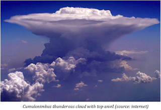
Over the past couple of weeks, stormy weather has gripped India, especially north India and to some extent south and north-east India (although not covered in the news as much as the thunder-and dust-storms in north India). The central and western regions have been undergoing somewhat of a lull period with no significant activity. Press coverage on recent storms can be accessed at - 1.  https://www.washingtonpost.com/news/worldviews/wp/2018/05/08/dust-storms-create-havoc-across-india/?noredirect=on&utm_term=.47578e1a2a9e 2.  https://scroll.in/article/878105/as-north-india-braces-for-thunderstorms-vague-weather-alerts-are-of-little-help 3.  https://www.independent.co.uk/news/world/asia/india-dust-storms-thunder-death-toll-weather-delhi-agra-rajasthan-uttar-pradesh-latest-a8335891.html Although thunderstorms are a common feature during the summer time, the freak event that occurred on May 2nd is very uncommon and could be attributed to the changing cli...

Onset of Indian summer monsoon

Image
The onset of Indian summer monsoon (or southwest monsoon) is the most anticipated event for the Indian population. The first monsoon shower is the most awaited one as many seek respite from the scorching heat, little ones gleefully wanting to play in the cool showers, and the agricultural community get in full swing to prepare the land for farming. Over the past few years, owing to climate change, the onset has been delayed ( https://www.firstpost.com/economy/imd-forecasts-delay-in-onset-of-monsoon-may-hit-kerala-coast-around-5-june-1971211.html ) and the monsoon itself has been erratic, with brief periods of heavy rain (active phase) and periods of no rain (break phase). This is in contrast to a decade or two back, when the onset on monsoon would be well-timed and the nature of monsoon was also steady (with consistent rains through out the season). However, urbanisation, greenhouse pollution, deforestation, and many other anthropogenic activities have led to the late onset and incon...

Wind motion and precipitation

Image
It is common for meteorologists to use terms such as a low pressure trough, depression, well-marked low, deep depression, cyclonic storm, and severe cyclonic storm . These are systems that are generally associated with inclement weather patterns. So how do meteorologists label these systems? In this blog, I would try and explain them in as simple terms as possible.  First, let us talk about winds and their motion. The two most important aspects of wind are speed (or intensity) and direction. In meteorological charts (one shown on the top right figure), a solid line with a slanted tail at the end indicates wind. The position of the slanted tail denotes the wind direction. If the slanted tail is to the right, then the wind direction is from right to left, if it is up, then north to south and so on.  The speed of the wind is denoted by the number of slanted tail(s). One tail indicates weak wind, two means moderate wind, and three would mean strong wind....

Indian Summer Monsoon 2018

Image
  A few days back, both Skymet weather services (a private weather forecasting firm) and the Indian Meteorological Department (IMD, a government organization) gave their predictions for the Indian summer monsoon 2018. Overall, they painted a positive picture, where both confirmed that monsoon 2018 is likely to remain normal at 100% (with error margin of +/-5%) of the long period average (LPA), where the nationwide LPA stands at 887 mm for the four-month period from June to September (for more details on this prediction see https://www.skymetweather.com/content/tag/monsoon-2018/ ). To elaborate, >105% of LPA indicates excess rainfall, <95% of LPA indicates below normal rainfall, and <90% of LPA indicates drought. Their prediction is based on the nationwide average and hence does not account for the state- and region-wise variabilities. Hence, although the prediction for 2018 is ‘normal rainfall’, this does not exclude the possibility of excessive rainfall in some regio...